
A brand new 45-mile fault line has been discovered stretching along Canada’s Vancouver Island, just north of the Washington state border, and may pose a tsunami risk to people nearby.
The fault line was suspected to be lurking in the region by geologists, mineralogists, and Earth and ocean scientists, who had recently found evidence of an earthquake occurring on the Saanich Peninsula between 4,700 and 2,300 years ago, according to new research in the journal Tectonics.
Proving difficult to find due to the thick forest coverage in the area, the fault line was finally found after intensive research. “In the northern Cascadia forearc on the west coast of North America, high-resolution topography and geologic mapping show a [approximately] 2.3-m-high scarp across a [approximately] 14,000-year-old land surface 10 km [6.2 miles] north of downtown Victoria, British Columbia, Canada,” a team of researchers from France, the U.S., and Canada wrote in the paper.
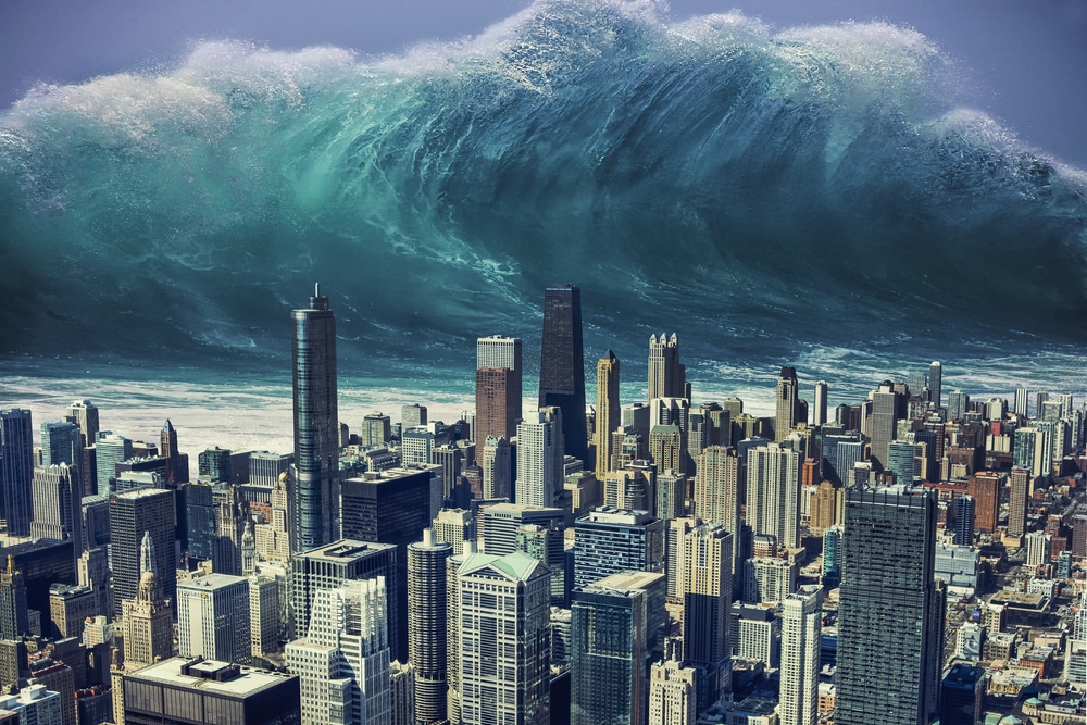
If the fault were to see an earthquake, it could trigger a tsunami that would be catastrophic to those living nearby in both Canada and on the U.S. West Coast.
On further investigation, they found that the faultline runs northwest to southeast for around 45 miles, and may be a slip-dip fault, meaning that the rocks move vertically up and down against each other, rather than sliding side to side.
In the paper, the researchers suggest that an earthquake at this faultline would likely trigger a tsunami that could hit the Canadian cities of Victoria and Vancouver, as well as places as far away as Seattle, Bellingham, Olympia and Tacoma in the U.S.


