
Hurricane Otis underwent rapid intensification and strengthened into a major Category 4 hurricane Tuesday as it swirled just off the southern coast of Mexico near Acapulco.
“Additional strengthening is forecast, and Otis is forecast to be a potentially catastrophic category 5 hurricane when the center reaches the coast,” the National Hurricane Center wrote in the 7 p.m. Central time advisory.
The storm will bring life-threatening storm surge, destructive waves and heavy rain to southwestern Mexico, which may result in flash flooding and mudslides in the higher terrain.
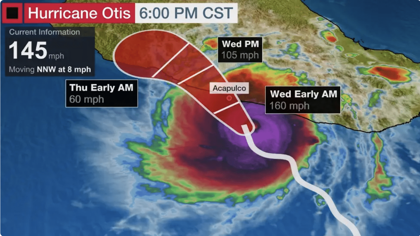
Otis is located about 85 miles south-southeast of Acapulco, Mexico, and is moving north-northwest at 8 mph, as of the latest advisory from the NHC. Otis has maximum sustained winds of 145 mph with some higher gusts.
Ahead of landfall, Otis is undergoing a process known as rapid intensification, which is when a tropical system increases in maximum sustained winds of at least 35 mph in 24 hours.
Additional strengthening is forecast and Otis is likely to be near Category 5 strength when its center reaches the coast Wednesday. Rapid weakening is likely after landfall.
The NHC said Otis will continue on a north-northwest motion over the next few days. On that current forecast track, the center of Otis will reach the southern coast of Mexico by early Wednesday.
A Hurricane Warning has been issued along the southern coast of Mexico from Punta Maldonado westward to Zihuatanejo, including the city of Acapulco.


