
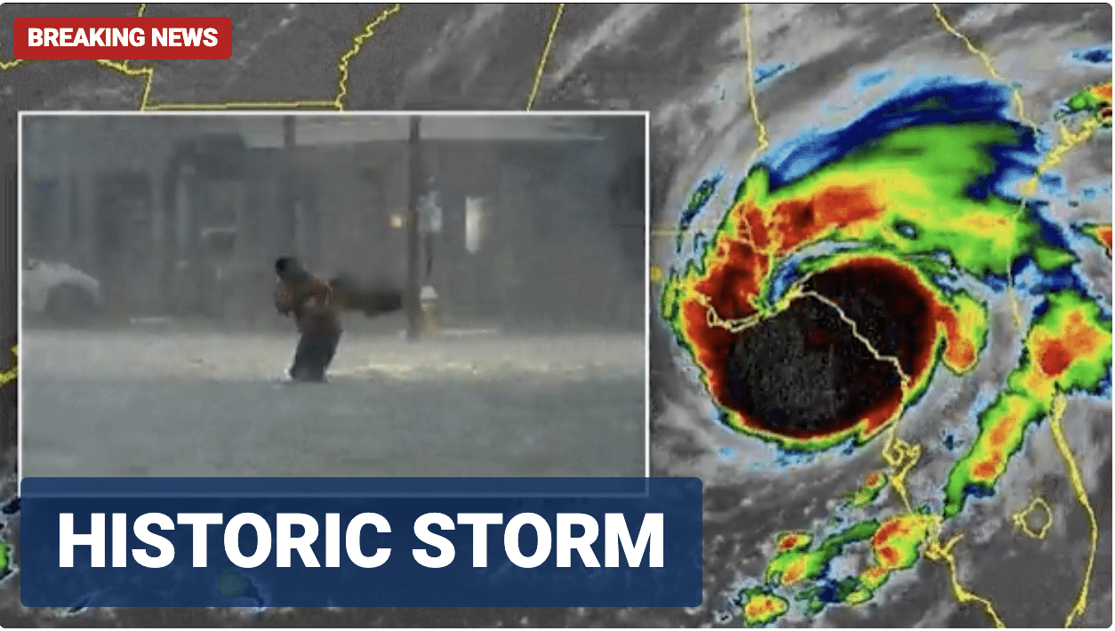
Hurricane Idalia has made landfall over Florida’s Gulf Coast as a “catastrophic” Category 3 storm that has already left tens of thousands of residents without power, officials said Wednesday morning.
Idalia is producing storm surges of up to 16 feet in some areas, damaging winds howling up to 125 miles per hour, and historic freshwater flooding that has completely encompassed Floridian roadways, according to the National Hurricane Center.
The National Weather Service in Tallahassee called Idalia “an unprecedented event” as no major hurricanes – those classified as Category 3 or higher – have made landfall through the Big Bend region since hurricane data was first recorded in 1851. The NWS also said “no one” has witnessed a storm strengthen to such magnitude in such a short time.
The storm passed the Apalachee Bay and made landfall over Florida’s Big Bend region, where the peninsula merges into the Panhandle. It is directly impacting Gainesville, Jacksonville, Tallahassee, Dowling Park, Lake City, Cedar Key, Chiefland, Newberry, Cross City, Apalachicola, Perry and other Florida cities. Its impact will also be felt in Orlando, Spring Hill, Bradenton, Bartow, Ocala, Lake Placid, Tampa, Sarasota, and Fort Myers.
Savannah and Brunswick are in the storm’s projected path as it is expected to continue a northeast path through the state and into Georgia.
In Cedar Key on Wednesday morning, water levels have already surpassed 10 feet, breaking the previous record of 5.99 feet during Hurricane Hermine in September 2016, according to the National Oceanic and Atmospheric Administration (NOAA).
Idalia was just a tropical storm on Tuesday but rapidly intensified over the warm waters of the Gulf of Mexico, through four different categories, obtaining Category 4 status at one point within 24 hours.
“Idalia is expected to produce a swath of 4 to 8 inches of rainfall with isolated [totals of] up to 12 inches from the Florida Big Bend through central Georgia and South Carolina, and through eastern North Carolina into Thursday,” the National Hurricane Center said in a Wednesday morning advisory. “These rainfall amounts will lead to areas of flash, urban, and moderate river flooding, with considerable impacts.”


