
Super Typhoon Mawar is nearing the U.S. territory of Guam with potentially catastrophic storm surge, high winds, and flooding rain in what could be its strongest, closest strike in at least 20 years.
Typhoon warnings have been issued by the National Weather Service for Guam, as well as Rota, an island about 40 miles north-northeast of Guam.
And while the Mariana Islands are in the most immediate danger, Mawar also has an uncertain future after striking Guam that could eventually pose a threat to other parts of the western Pacific Basin next week. Here is what you need to know about this typhoon.
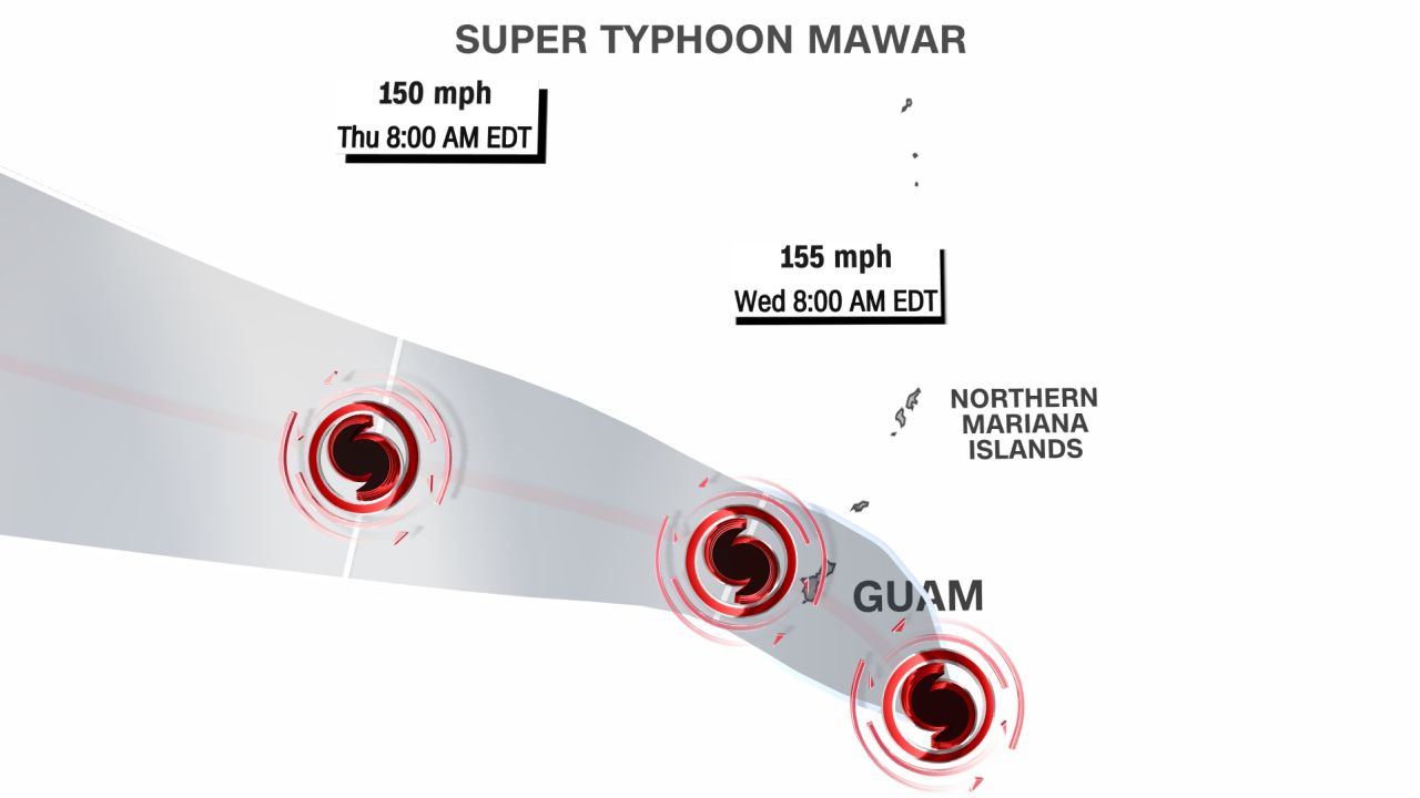
Mawar became a super typhoon early Tuesday (U.S. Eastern Daylight Time), which means it has winds of at least 150 mph. That’s the equivalent of a strong Category 4 hurricane.
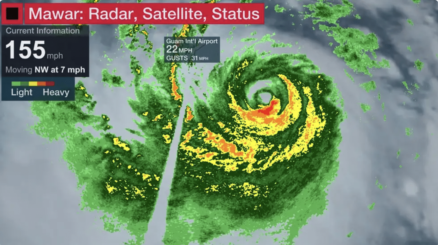
While Mawar could briefly hit Category 5 strength as it passes near Guam, a 5 or 10-mph difference in winds won’t make much difference in the potential for extreme impacts. As you can see in the map below, some rainbands are sweeping into Guam and the Marianas, with heavy rain and some stronger gusts.
Mawar has been described as “one that will be remembered for decades,” said Landon Aydlett, the Warning Coordination Meteorologist from the weather service in Guam. It is expected to strike the island – and possibly make a direct landfall – on Wednesday afternoon, local time (around or just after midnight on Wednesday, Eastern Time).
If the typhoon does make a direct landfall, the island would be thrashed with the storm’s strongest winds and highest storm surge. Though Guam is located in the West Pacific Ocean – an area prone to the world’s strongest tropical cyclones – a direct hit from a storm this strength is exceedingly rare, and has only happened around eight times in the last 75 years. The island is just 30 miles long, so the center of a storm moving over would be akin to threading a tiny needle.
Forecasters warned that Mawar could strengthen further on Tuesday, potentially reaching the equivalent of a category 5 hurricane, with winds in excess of 157 miles per hour, before landfall. If this were to happen, Mawar would be the fifth category 5-equivalent storm on the planet to-date this year – the average number for an entire calendar year – and hurricane and typhoon seasons are only just beginning.
It would also mark the strongest storm to directly impact Guam since Super Typhoon Karen in 1962, which is widely regarded as the worst storm to ever hit the island, with sustained winds of 172 mph.


