
Waterlogged California faces one of its most serious flood threats Tuesday in what’s already been a historically stormy season. The National Weather Service has declared a “high risk” of excessive rainfall in both coastal and mountainous zones as yet another strong atmospheric river bombards the state.
According to MSN, The Weather Service issues such “high risk” proclamations only about 15 times a year across the country, but they are associated with 80 percent of flood losses and 39 percent of fatalities.
The atmospheric river is hitting California just four days after President Biden declared a state of emergency “resulting from severe winter storms, flooding, landslides, and mudslides beginning on March 9, 2023, and continuing.”
Through late morning, Tuesday’s atmospheric river had unleashed wind gusts up to 50 mph near the coast and 70 mph in the high terrain, up to several inches of rain, and more than a foot of snow in the high terrain.
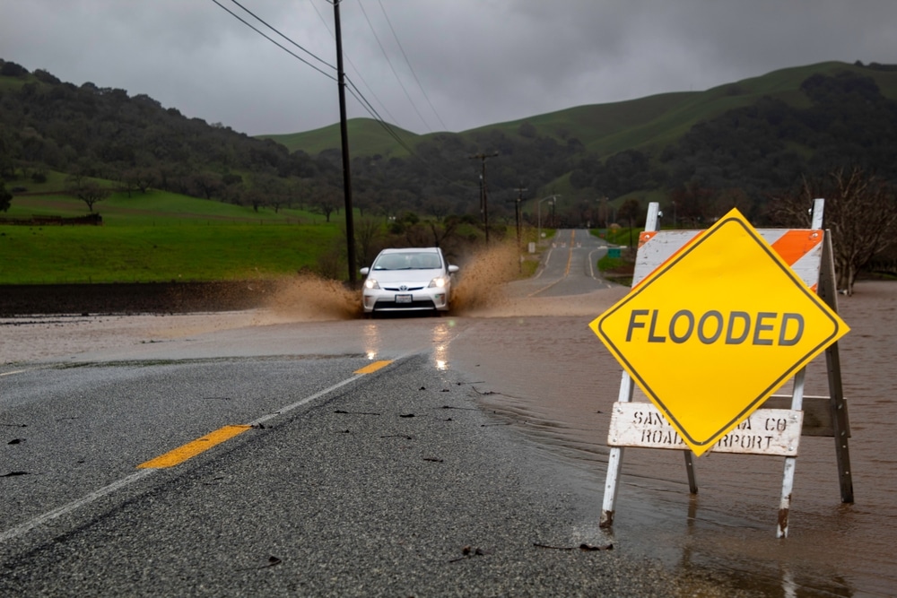
The Weather Service office serving the area around Sacramento reported flooded roads in interior Northern California while the Weather Service’s Bay Area office posted a report of roadway flooding near the Salinas River.
The Bay Area office also tweeted that it had received reports of “several trees and power lines down” across the San Francisco and Monterey Bay areas. Utility tracker PowerOutage.US reported over 100,000 customers without power across the state.
But water — not wind — is the Weather Service’s greatest concern. The agency is warning of “locally catastrophic flooding impacts expected for portions of the coast, Central Valley, and the Sierra Nevada foothills.”
One of the high-risk areas covers the central Sierra Nevada, stretching from Yosemite National Park to east of Fresno. That’s where heavy rainfall totaling 3 to 6 inches will combine with rapid snowmelt to overwhelm area creeks and rivers. Some areas could see in excess of 8 inches.
A second high-risk zone has been introduced for the central California coastline and the coastal range from near Monterey to just west of Santa Barbara. Flood watches expand into Southern California, including the Los Angeles area, and extend across much of central and Northern California.
Burn scar areas in parts of Southern California are at risk of dangerous debris flows. Ahead of the storm Monday, evacuation orders were given to residents in Santa Barbara County residing near the Alisal or Cave burn scars.
Santa Barbara is expecting 3 to 5 inches of rain through late Tuesday night. Winter storm warnings are in effect for the Sierra Nevada, since primarily snow is expected to fall above 6,500 or 7,000 feet. Totals may reach 8 feet in the highest mountain peaks.


