
Severe weather will threaten parts of the South this weekend with tornadoes, damaging winds, hail, and flooding rainfall. According to the Weather Channel, A large-scale jet stream disturbance and its sweeping cold front are moving from out of the Rockies toward the central and eastern states into a springlike, record-warm air mass for this time of year over the South.
This setup will ignite a new round of severe storms in the South, while also generating winter weather in the Midwest. This weather is all a part of Winter Storm Frida. Heavy rain will push east and northeastward through the Ohio Valley and into the Northeast overnight while thunderstorms move eastward through the South.
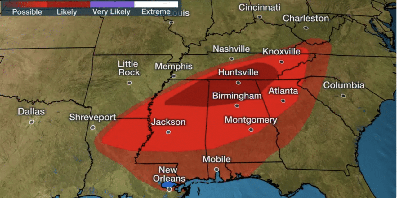
We expect a squall line of severe thunderstorms to march eastward from the Mississippi River into parts of Tennessee, Mississippi, Alabama, and Georgia during Saturday night into early Sunday. Some storms may reach the western Florida Panhandle.
Meanwhile, Kentucky Gov. Andy Beshear has declared a state of emergency, due to severe storms and flooding reported in much of Kentucky on New Year’s Day. The storm comes just three weeks after one of the deadliest and largest December tornado outbreaks in modern United States history struck Kentucky and other Midwest states from Dec. 10-11.
Thousands are working to pick up the pieces, and the state reported a death toll of at least 76 people from that outbreak. Gov. Beshear says heavy rain, possible tornadoes, hail, and straight-line winds on New Year’s Day have impacted parts of Western, Eastern, and South Central Kentucky.
The governor’s office says flash flooding in Green, Barren, Taylor, Adair, Owsley, Breathitt, and Casey Counties led to road closures in water rescues. Casey County and Owsley County have declared local states of emergency.


