
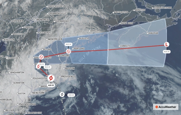
(ETH) – More than 130,000 homes and businesses were without power after Tropical Storm Henri made landfall in Rhode Island Sunday afternoon, knocking down trees and power lines and bringing flooding rainfall to some areas.
The Weather Channel stated that mandatory evacuations were ordered in some communities and several areas are under a state of emergency. Continued dangerous, heavy rainfall is possible as Henri moves further across land. “Rainfall flooding has dominated the story with Henri and will probably continue to do so,” weather.com senior meteorologist Jonathan Erdman said Sunday afternoon.
The towns on our southern border have major flooding. Nearby Jamesburg Boro flooding. (Courtesy @CBSNewYork) pic.twitter.com/Vx0PZYr4gq
— So Brunswick PD (@SoBrunswickPD) August 22, 2021
The Red Cross opened multiple shelters across the Northeast. Local municipalities also opened shelters. COVID-19 protocols are in place. Hundreds of flights are delayed or canceled at major airports including LaGuardia, Kennedy, Boston Logan, and Newark. According to CNN, The Weather Prediction Center has issued a level 3 of 4 risk for excessive rainfall in parts of the Northeast for Monday into Monday night due to Tropical Storm Henri.
This is considered a moderate risk. This includes southern New York and much of central and southern New England and the cities of Hartford, Albany, Springfield, and Bridgeport. Henri’s slow forward motion over the northeastern US will make for favorable conditions for flash flooding to occur with scattered, heavy showers and thunderstorms expected through the day Monday.
Forecast rainfall totals between Monday and early Tuesday morning are expected to be in the 1 to 3-inch range for areas in this moderate risk. Similar to the flooding situation in the New York City area Sunday afternoon, there will be the risk for pockets of heavier rain that stall over a given location, thus making flooding likely Monday. In these situations, isolated rainfall totals can amount to around 6 inches.


