
(TWC) – A dangerous tornado outbreak is likely to hit the South on Thursday, including the possibility of several intense tornadoes, damaging winds, very large hail and flash flooding. Some of the severe weather could extend as far north as the Ohio Valley.
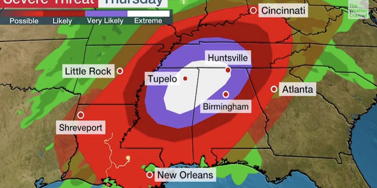
NOAA’s Storm Prediction Center (SPC) has issued a rare “high risk” severe weather forecast for today from northern parts of Mississippi and Alabama into a portion of south-central Tennessee. In its Thursday morning discussion the SPC said, “any relatively discrete supercells will be capable of multiple tornadoes, some long-tracked and strong to violent (EF2-5 possible), with considerable destructive potential”.
Showers and thunderstorms are spreading across the South right now, with a few of them turning severe at times. The threat of widespread severe storms and tornadoes will rapidly increase through the afternoon.
A “particularly dangerous situation” tornado watch has been issued until 8 p.m. CDT/9 p.m. EDT from central and southern parts of Mississippi into western and northern Alabama, south-central Tennessee, and far northwest Georgia.
This watch area includes Jackson, Columbus and Tupelo, Mississippi, Birmingham and Huntsville, Alabama, and Rome, Georgia. As mentioned earlier, the high-risk area shaded white in the map below has the greatest likelihood of long-tracked, intense tornadoes and very large hail. That includes Tupelo and Columbus, Mississippi, and Huntsville, and Birmingham, Alabama. READ MORE


