
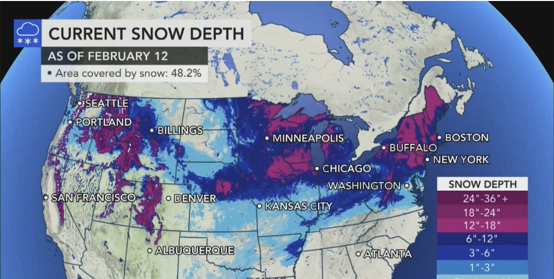
(Accuweather) – If it feels like winter has been serving up more wild weather than usual lately, that’s because it has been.
According to AccuWeather meteorologists, this recent frosty stretch of snow, ice and frigid temps has been the most active winter weather pattern across the country likely since the mid-1990s.
And that pattern is not letting up as several weather systems are lining up and threatening more snow and ice for the Midwest and Northeast through the end of next week.
Winter storms could arrive every two to three days amid the tumultuous pattern, which is due in part to a major buckling of the jet stream.
The river of high winds aloft plunged southward over the central United States then swung up along the Atlantic coast in recent days, setting the path for storms to ride along.
That active storm track will be fueled by the collision of Arctic air sprawling across the middle of the nation and milder air holding its ground in the Southeast.
Two systems will come into play during the next storm this weekend, including on Valentine’s Day in the Northeast. READ MORE


