
(TWC) – The hits just keep coming as Mother Nature prepares to throw down her gloves and send bare-knuckled punch after punch of winter weather to the eastern half of the United States. Following a blockbuster snowstorm to start the month of February and another weekend snow event, residents of the Midwest and Northeast have barely had time to catch their breath this month.
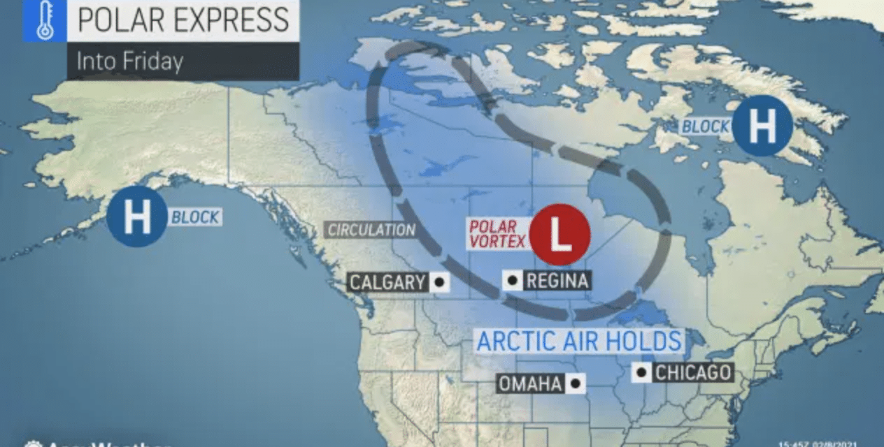
The weather pattern is beginning to sound like a broken record for many residents of the eastern half of the U.S. as snowy and cold weather shows no signs of letting up anytime soon thanks to the displaced polar vortex and brutally cold Arctic air in place.
Following a storm that spread minor snow accumulations across the Midwest Monday and pushed into the Northeast Tuesday, some residents will have to quickly ready themselves for another, more potent, storm that will deliver a mix of rain, ice, and snow to some places, thunderstorms and rain farther to the south, and all-out snow to points farther to the north across a 1,500-mile stretch of the country.
Unlike the early-week, quick-hitting storm for the eastern U.S., this next system is expected to take its time and become a long-duration snow and ice event. Another deviation from the pattern during other storms this month will be a surge of cold air farther to the south. That will usher in the opportunity for snow and ice into parts of Missouri, Oklahoma, and Arkansas as early as Tuesday afternoon. However, the bulk of the precipitation with this storm will really begin to get going by Wednesday morning. READ MORE


