
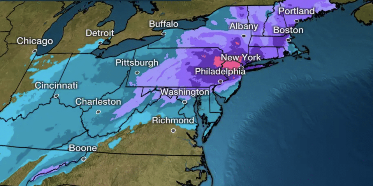
(TWC) – Winter Storm Orlena is set to pummel the East Coast with heavy snow and strong winds expected from parts of New England to the northern mid-Atlantic, including the Boston, New York City, and Philadelphia metro areas. Here’s a look at where the storm is now followed by the forecast for what’s to come.
Snowfall will intensify as it moves northward from the mid-Atlantic states toward the New York City Tri-state through Sunday night and early Monday. However, some lingering dry air may keep most of southern New England dry for the time being. Snow will also expand Sunday night in the Ohio Valley, extending as far south as Kentucky, Tennessee, and the Great Smoky Mountains, while coming to an end across the Upper Midwest.
Winter storm warnings and winter weather advisories are in effect from the Appalachians and mid-Atlantic states into New England. The worst winter conditions are generally expected in the areas under winter storm warnings. Orlena will bring widespread moderate to major (locally extreme) impacts across the Northeast, as depicted below in the latest Winter Storm Severity Index from NOAA.
The index takes into account snow, ice, wind, temperatures, location, and population to determine the expected impact from a winter storm. One of the expected impacts is that travel in the Northeast will be severely disrupted by the snow and strong winds from Orlena into Tuesday. READ MORE


