
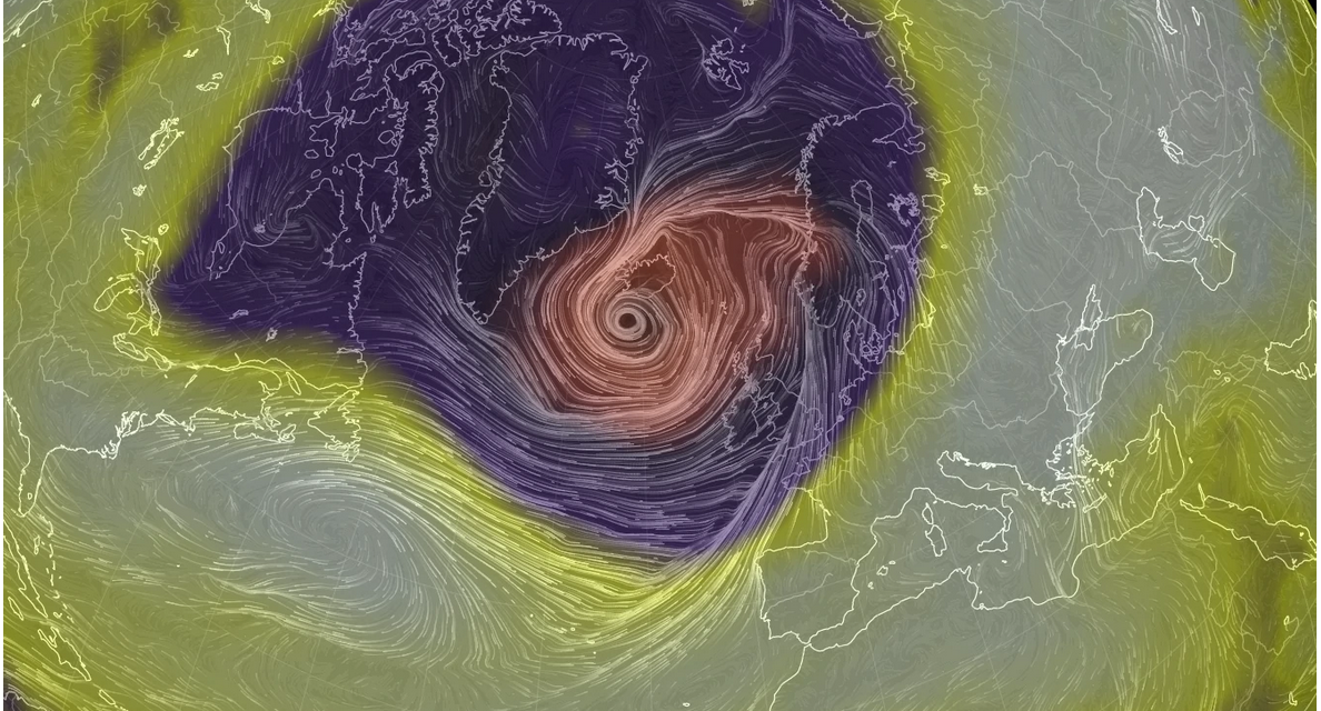
(WP) – A potentially unprecedented scenario is unfolding in the North Atlantic on Friday, as a bomb cyclone batters Iceland with hurricane-force winds and blizzard conditions, just as another bomb cyclone, known as Storm Dennis, rapidly intensifies behind it. Ultimately, the two storms will enter into a complex dance around each other before combining into one atmospheric behemoth, with a minimum central air pressure that could rank among the top three most intense storms ever observed in the stormy North Atlantic Basin.
Already on Friday morning, the first bomb cyclone, which has a minimum central air pressure of 929 millibars, roughly equivalent to a Category 4 hurricane, is slamming Iceland with blizzard conditions, mixed precipitation and heavy rain. Winds have been clocked at about 70 mph in the capital city of Reykjavik, and 90 mph at the international airport in Keflavik. The forecast called for gusts of higher than 120 mph in a few locations, particularly on the western coast of the island, though conditions were improving early Friday afternoon local time. FULL REPORT


