
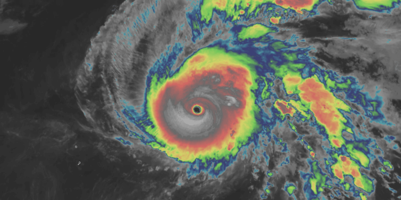
(WP) – Super Typhoon Halong is raging in the open waters of the western tropical Pacific Ocean right now, with satellite imagery estimating its peak winds at close to 190 mph. It’s every bit a Category 5 storm and then some, its extreme strength coming three days after it drifted lazily as a tropical depression.
Halong isn’t moving toward land, but its mesmerizing fury and terrifying beauty is capturing the attention of meteorologists worldwide. Halong’s path to metastasizing into a monstrosity stemmed from seemingly innocuous origins Saturday, as an area of low pressure blossomed into a tropical depression several hundred miles east of the Northern Mariana Islands.
Hours later, it bloomed into Tropical Storm Halong. Halong got its act together gradually, ramping up into a Category 2 hurricane by Monday. That’s when the storm rapidly intensified overnight into a Category 5-equivalent buzz saw. As of noon Tuesday, the Joint Typhoon Warning Center estimated Halong’s intensity at 160 mph. But there are plenty of reasons to believe that may be conservative and that Halong is still intensifying. READ MORE


