
(WP) – On the brink of Category 5 status, Cyclone Kyarr is a monster. The Indian Ocean beast — dubbed a top-tier “super cyclonic storm” by the India Meteorological Department — is the first storm of such intensity to rage in the Arabian Sea in 12 years. While Kyarr will remain largely out to sea, it’s “very likely to maintain” intensity through Monday night before beginning to curve west-southwest. It has also helped propel 2019 into the top spot for most active North Indian cyclone season on record.
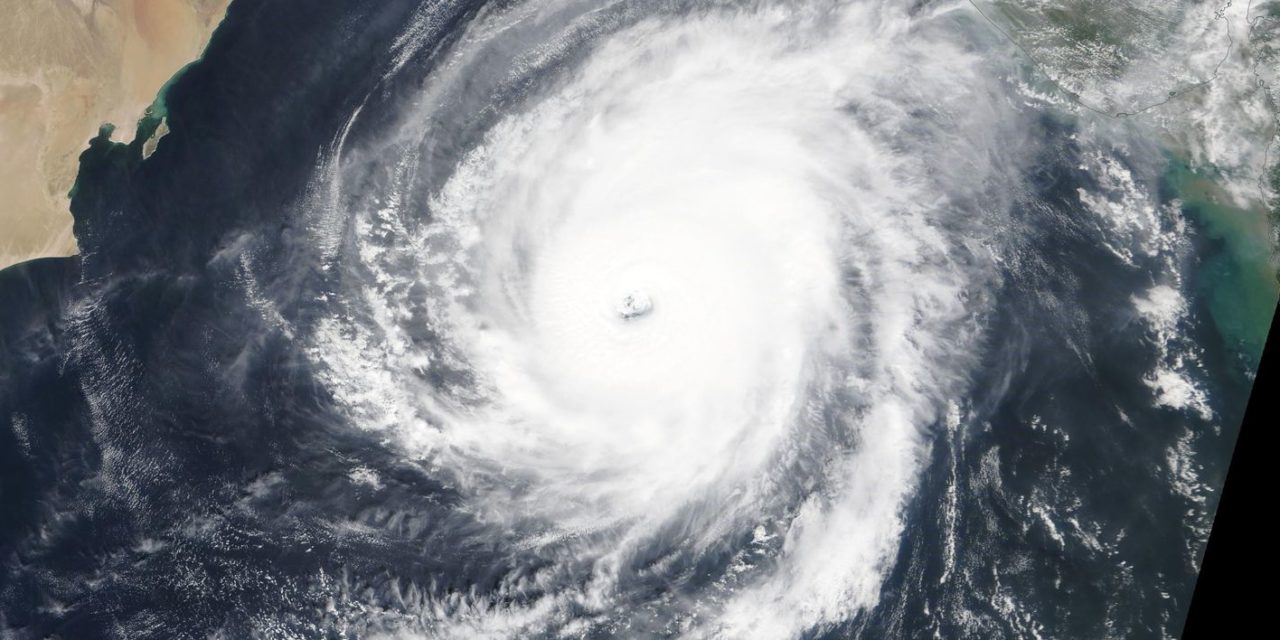
Now, Kyarr has maximum one-minute sustained winds of 150 mph, with gusts approaching 185 mph in the storm’s eyewall, the zone of most extreme winds. That puts it 7 mph below the threshold of equivalent Category 5 status. Satellite imagery captured its stunning symmetry Monday morning, Kyarr exhibiting its well-structured banding and translucent, mistily veiled eye. Crystal-clear skies can be seen to the northwest of the storm, where sinking outflow air suppresses any cloud growth. Outflow channels are also visible in the banded, wispy tendrils of cloud protruding like fingers out of the storm’s southern tier. READ MORE


