
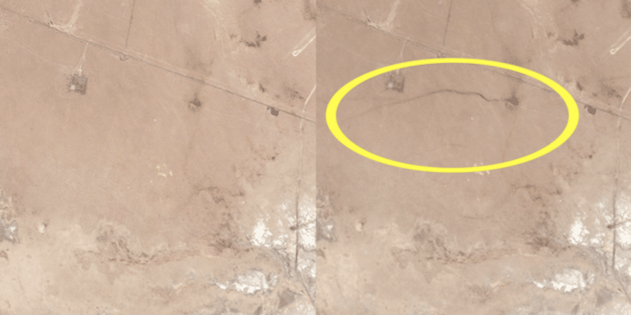
(KTTV) – The powerful 7.1 earthquake that shook Southern California on Friday appears to have also caused a crack in the earth’s surface that was captured by satellite cameras from space. Satellite imagery from Planet Labs Inc., taken on July 4 and July 6, appears to show changes in the area close to the quake’s epicenter.
Planet Labs Co-Founder and CEO Will Marshall tweeted the images, adding that the before and after “clearly show surface rupture.” Friday’s quake initially registered as a 7.1, but was downgraded to a 6.9, then upgraded back to a 7.1 by the USGS. In addition to changes in topography in the area, the temblor led to structural damage of homes, shattered glass, power outages and more. READ MORE
Advertisement


