
(CBN) – Waves of winterlike weather have already delivered helpings of record-setting, early-season snow and intrusions of cold air over the north-central United States. And forecasters warn that more wintry weather is in the pipelines for parts of the western and central U.S. in the coming weeks.
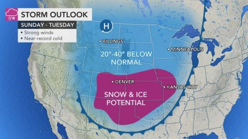
A blast of frigid air may not only shatter records but also deliver cold more on par with the middle of winter to parts of the Rockies and Plains, laying the groundwork for an unusual snowfall far to the south for late October. An Arctic outbreak even more extreme than one felt in early September is expected to race southeastward from the northern Rockies Friday night to the southern Plains on Monday and could deliver temperature departures from an average of 30-40 degrees Fahrenheit.
The air is forecast to be so cold at its peak as to bring nighttime low temperatures to within a few degrees of zero in parts of Idaho and much of Montana and Wyoming, as well as the western parts of the Dakotas and northern Colorado. For example, “in Billings, Montana, the temperature is forecast to shatter the current record of 18 set in 1997 Saturday night by at least 14 degrees and to blow away the record low of 22 set in 2002 on Sunday night by 22 degrees,” according to AccuWeather Meteorologist Reneé Duff.
The normal low temperature in Billings during late October is in the middle 30s, but even in the middle of January, the average low is 18 degrees. In Missoula, Montana, the low could plummet to a bitter 3 degrees on Saturday night, nearing the all-time record low for October of zero degrees set back in 1971. MORE


