
URGENT (ETH) – Hurricane Laura has just strengthened into a catastrophic Category 4 as it is barreling down on the Gulf for a destructive landfall near the Texas and Louisiana border.
Destructive storm surges and damaging winds are forecasted to pummel the region along with a threat of flooding rain and strong winds that will extend well inland. Local officials are sounding the alarm to residents along the upper Texas and southwest Louisiana coasts urging them to finish preparations now and prepare for a major hurricane strike.
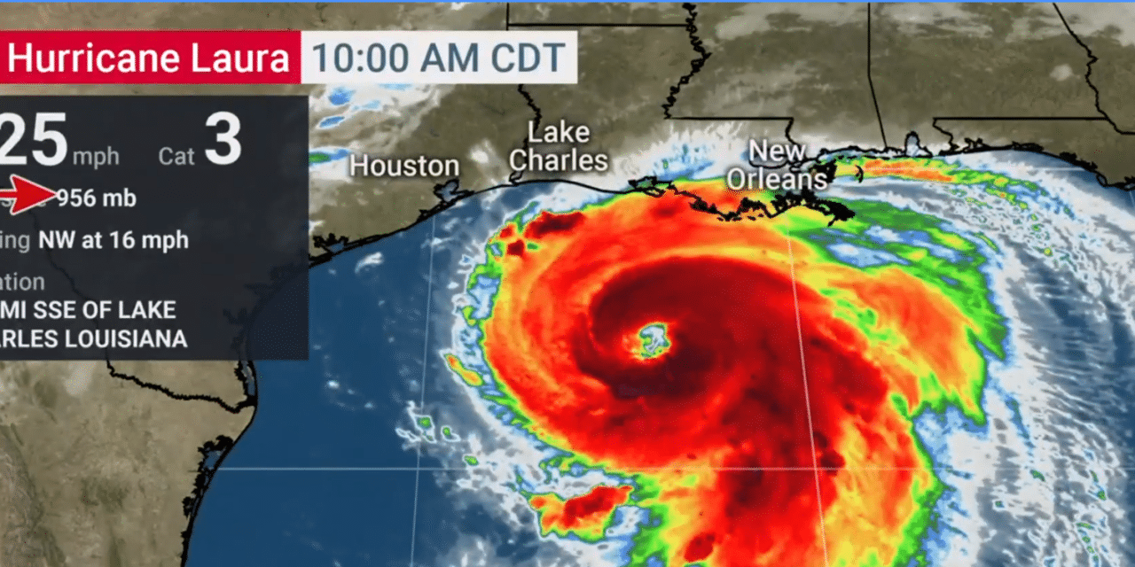
They are pleading residents tp follow any evacuation orders issued by local or state officials. According to the Weather Channel, Laura is centered about 200 miles south-southeast of Lake Charles, Louisiana, and to the northwest at 16 mph.
The hurricane has now reached a catastrophic Category 4 with wind speeds at 140 mph. Laura’s maximum sustained winds leaped from 75 mph to 140 mph in the past 24 hours ending 1 p.m. CDT Wednesday.
That increase in maximum sustained winds easily meets the definition of rapid intensification in a hurricane. There has already been wind gust registered at 107 mph that was reported at a buoy near the center of Laura early Wednesday morning.
A life-threatening storm surge is expected along the Gulf Coast in the next 36 hours and officals are pleading with residents to heed all evacuation orders and instructions from local emergency management and take necessary precautions to protect life and property.


