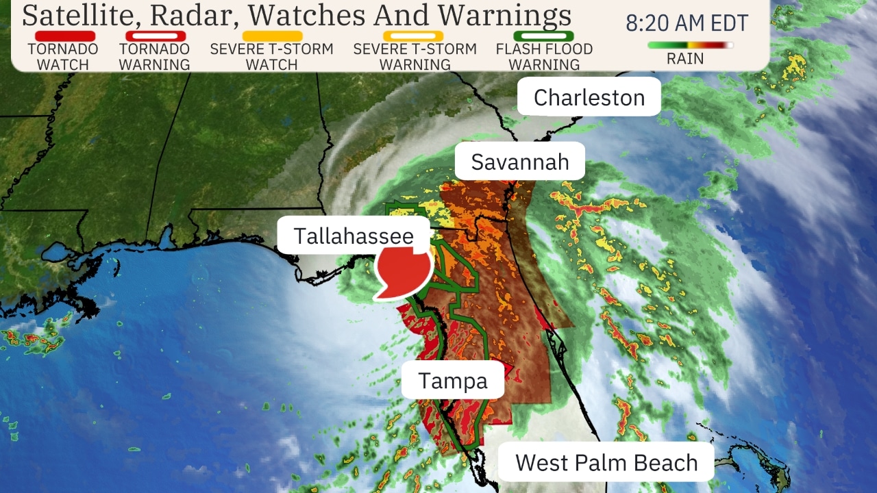
Hurricane Debby has made landfall in Florida’s Big Bend region, which will now be followed by a halt in its forward speed that could result in historically heavy rainfall triggering flooding in parts of the Southeast. Dangerous storm surge, strong winds gusts and a few tornadoes are also accompanying Debby.
Debby made landfall near Steinhatchee, Florida, with maximum sustained winds of 80 mph at 7 a.m. EDT, according to the National Hurricane Center.
NOAA has issued their highest level of flood outlook for the next few days, shown in pink on the maps below. These areas could experience damaging and life-threatening flooding flash flooding and river flooding
The National Hurricane Center stated in their Monday morning discussion that “potentially historic heavy rainfall across southeast Georgia and the coastal plain of South Carolina through Saturday morning will likely result in areas of catastrophic flooding.”
Flooding from rainfall could be exacerbated by winds blowing onshore along the Southeast coast. That can prevent floodwaters from draining away toward the ocean.
The hurricane is spreading heavy rain from the Florida Peninsula to southern Georgia this morning, triggering some flash flood warnings.
A tornado watch is in effect until 4 p.m. EDT for northern and central Florida and southeast Georgia.
Winds have gusted over 60 mph this morning in Florida’s Big Bend region. Moderate coastal flooding from more than 4 feet of storm surge has been observed in Cedar Key.
Now that Debby is inland, it will track northeast for a time toward southern Georgia before slowing down and then meandering near the Southeast coast much of this week.
While it could restrengthen some if the center moves back over water, the main result of the stalled forward motion is that its impacts in the Southeast, especially serious flooding, will be prolonged.


