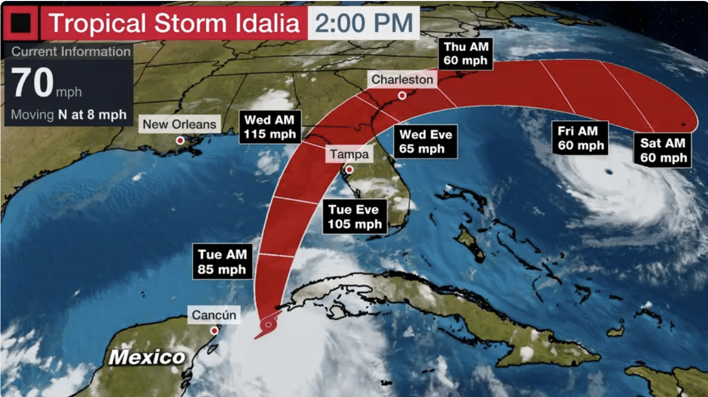
Floridians are bracing for a major hurricane strike on Wednesday as Tropical Storm Idalia has begun to strengthen while churning west of Cuba. AccuWeather hurricane experts say the storm will rapidly intensify into a powerful major hurricane on Tuesday over the Gulf of Mexico before making landfall in the state.
An ‘extreme’ risk for impacts is now in place for a portion of the Sunshine State, centered around the Big Bend region bridging the Gulf coasts of the panhandle and peninsula. This area will be most at risk for life-threatening storm surge flooding, damaging winds and torrential rain as Idalia approaches as a hurricane on Wednesday morning.
A hurricane warning is in effect for the west coast of Florida, extending from the eastern part of the Panhandle, encompassing Tampa Bay and points south of there. Tropical storm watches and warnings are also out for other regions of Florida’s Gulf Coast, including the Florida Keys.
Officials have issued mandatory evacuation orders on Monday for parts of Pinellas and Hillsborough counties in Floria due to life-threatening conditions anticipated.
Life-threatening storm surge, damaging winds and flooding rain are all expected from parts of Florida later Tuesday through Wednesday, spreading to the Southeast coast by Wednesday and Thursday.
If you live in an area prone to storm surge, be sure to follow the advice of local officials if evacuations are ordered. The latest on how people are preparing for Idalia can be found here.
Here’s where Idalia is now and where it’s headed: Idalia is centered between western Cuba and Mexico’s Yucatan Peninsula. The storm is forecast to become a hurricane later Monday as it crawls northward.
The latest data suggest Idalia should move northward into the Gulf of Mexico and then turn toward the northeast. On that track, the hurricane would make landfall on Wednesday along Florida’s Gulf Coast. After that, most computer models suggest it would take a bend, tracking through Georgia and the Carolinas through Thursday.
Gulf of Mexico water remains very warm, even by late August standards. Idalia is also likely to get a boost from its track over the Gulf of Mexico loop current, a northward flowing ribbon of deeper, warmer from the western Caribbean Sea into the southeastern Gulf of Mexico.
All other factors equal, warmer water can provide more fuel for a tropical storm or hurricane to intensify. Furthermore, computer models suggest upper-level winds will become favorable for quick intensification.
The National Hurricane Center noted in its Monday morning discussion that “rapid intensification is becoming increasingly likely before landfall.”
Therefore, the National Hurricane Center is forecasting Idalia to become a hurricane Monday and be near or at Category 3 intensity before its Florida landfall.


