Strong, long-track tornadoes, damaging winds, large hail and flash flooding could hit the South as an outbreak of severe thunderstorms erupts later today.
Severe weather is possible from the northern Gulf Coast into the Ohio Valley, but the area of most concern is in the lower Mississippi Valley.
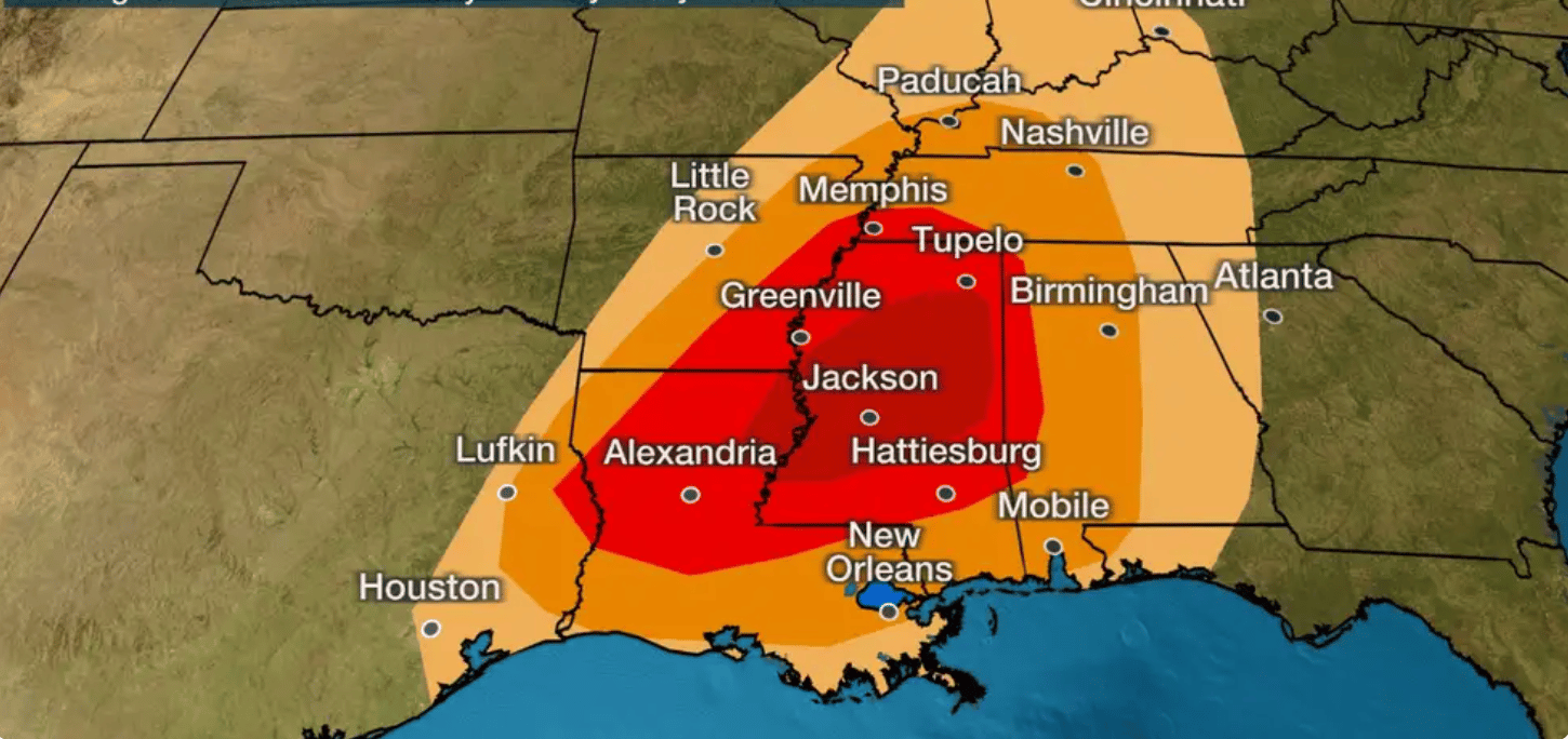
That includes locations from northern and central Louisiana into much of Mississippi, southeastern Arkansas, southwestern Tennessee and western Alabama, as depicted in the red shadings on the map below. Alexandria and Monroe, Louisiana, Jackson, Hattiesburg and Tupelo, Mississippi, and Memphis, Tennessee, are some of the cities in this zone.
Strong tornadoes, large hail and destructive straight-line winds are most likely in this region, with the peak timing expected to be mid to late afternoon through the evening hours.
Severe weather could spread as far east as the rest of Alabama, northwest Georgia, middle and eastern Tennesse, central Kentucky and the upper Ohio Valley by overnight into early Wednesday morning. Damaging winds will be the primary threat in these areas, but a few tornadoes are possible.
Be sure to have multiple ways to receive warning information if you live in areas at risk for severe weather, including smartphone apps and/or NOAA weather radio that can wake you when a warning is issued.
The potential for severe weather will decrease on Wednesday. That said, spotty damaging wind gusts and an isolated tornado could accompany any storms that turn severe from the northern Gulf Coast into much of Georgia and western South Carolina. (SOURCE)


