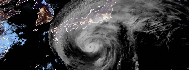
(The Watchers) – Extremely dangerous Typhoon “Hagibis” is approaching Japan. Landfall is expected near Tokyo on October 12 with maximum sustained winds of 160 km/h (98 mph), equivalent to Category 2 hurricane on the Saffir-Simpson Hurricane Wind Scale. Authorities are urging residents and tourists to prepare in advance and protect their lives.
- The Japan Meteorological Agency (JMA) said Hagibis has the potential to bring record-breaking rain and winds.
- Hagibis could be on par with Typhoon “Kanogawa” of 1958 that left hundreds of thousands of homes flooded and more than 1 200 people dead in the Kanto region and Izu archipelago.
- Prolonged power and water outages are expected. Prepare.
“The typhoon may make landfall in the Tokai or Kanto region on Saturday, and remain extremely strong. In addition to storm winds and high waves, we’re looking at the possibility of record rainfall around the Kanto region,” JMA’s forecast chief Yasushi Kajihara said. “To protect your own life and your loved ones, please try to start evacuating early before it gets dark and the storm becomes powerful.”
Heavy to record-breaking rain is expected in wide parts of Honshu, especially in Tokai and Kanto. Wind speeds may reach up to 162 km/h (100 mph) in Tokai and 144 km/h (90 mph) in Kanto-Koshin. Maximum gusts of 216 km/h (134 mph) may hit both regions. READ MORE


