
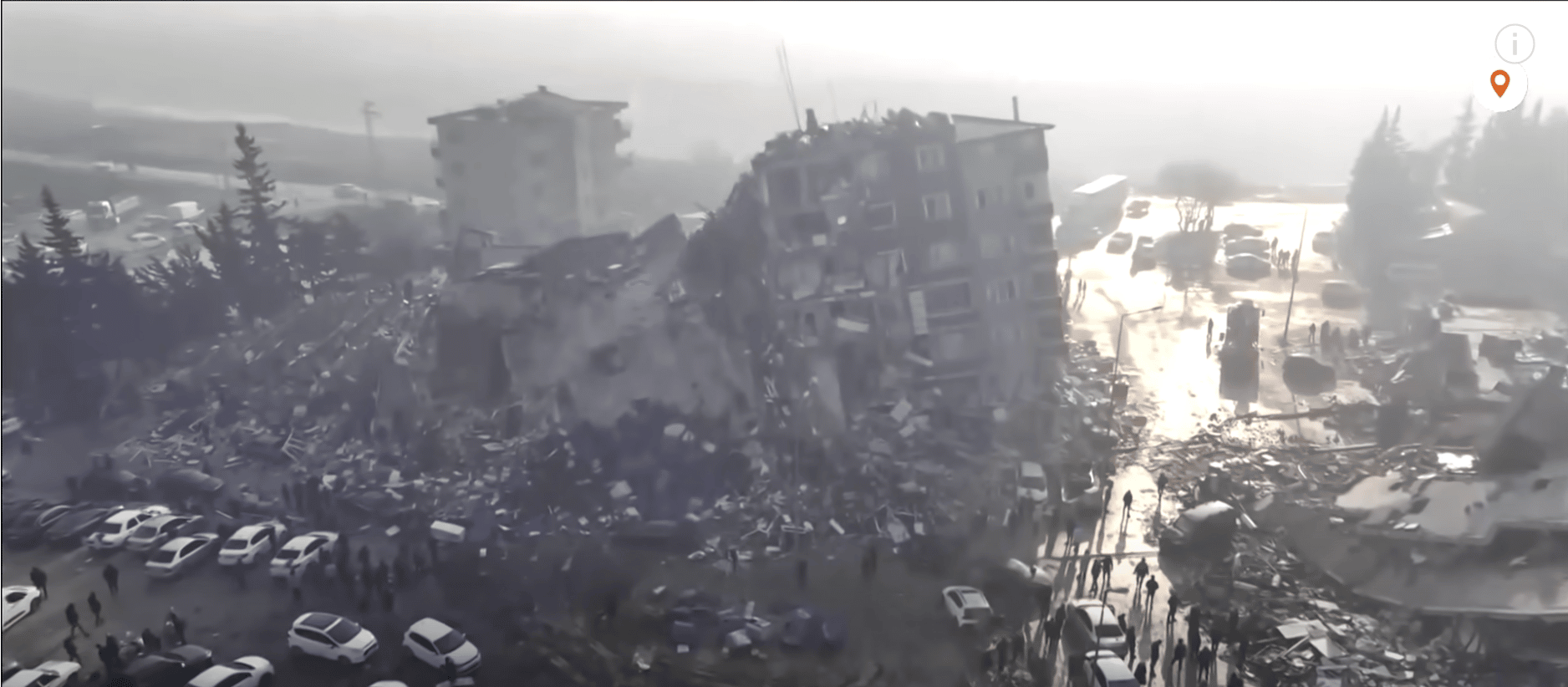
Two enormous cracks in Earth’s crust opened near the Turkish-Syrian border after two powerful earthquakes shook the region on Monday (Feb. 6), killing over 20,000 people.
Researchers from the U.K. Centre for the Observation & Modelling of Earthquakes, Volcanoes & Tectonics (COMET) found the ruptures by comparing images of the area near the Mediterranean Sea coast taken by the European Earth-observing satellite Sentinel-1 before and after the devastating earthquakes .
The longer of the two ruptures stretches 190 miles (300 kilometers) in the northeastern direction from the northeastern tip of the Mediterranean Sea. The crack was created by the first of the two major tremors that hit the region on Monday, the more powerful 7.8-magnitude earthquake that struck at 4:17 a.m. local time (8:17 p.m. EST on Feb. 5).
Surface rupture at Hassa Town. #earthquake #deprem pic.twitter.com/klsw2zesYj
— OzdemirAlpay (@geodesist_a) February 8, 2023
The second crack, 80 miles long (125 km), opened during the second, somewhat milder 7.5-magnitude temblor about nine hours later, COMET said in a tweet on Friday (Feb. 10).
Such ruptures appear commonly after powerful earthquakes, professor Tim Wright, who leads the COMET team, told Space.com in an email. These two fissures, however, are unusually long, a testament to the enormous amount of energy the earthquakes unleashed.
“The bigger the earthquake, the bigger the fault and the more it slips,” Wright wrote. “This earthquake fault is one of the longest on record on the continents. Also very unusual to have two such large earthquakes happening within a few hours of each other.”
The movement of the tectonic plates that caused the earthquakes was such that the cracks are clearly visible on the surface, running through towns and in some cases directly through buildings.
“We estimate presumably horizontal displacements of rarely up to 5 meters [16 feet],” COMET researcher Milan Lazecky told Space.com in an email. “Indeed, such large displacements of the terrain cannot be missed by people living in those regions.” (SOURCE)


