
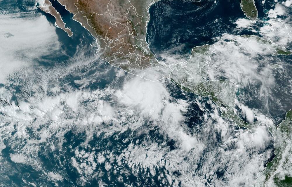
Hurricane Agatha, the season’s first, headed for a stretch of tourist beaches and fishing towns on Mexico’s southern Pacific coast Monday amid warnings of dangerous storm surge and flooding from heavy rains.
After forming on Sunday, Agatha quickly gained power, and it was predicted to make landfall as a strong Category 2 hurricane Monday afternoon or evening, the U.S. National Hurricane Center said. It was moving toward the area near Puerto Escondido and Puerto Angel in the southern state of Oaxaca — a region that includes the laid-back tourist resorts of Huatulco, Mazunte, and Zipolite.
The hurricane center said Agatha could “bring an extremely dangerous storm surge and life-threatening winds.” Early Monday, Agatha had maximum sustained winds of 110 mph (175 kph) — just 1 mph under the threshold for a Category 3, the hurricane center said. The storm’s center was about 65 miles (110 kilometers) southwest of Puerto Angel and heading to the northeast at 6 mph (9 kph).
Within six hours of being designated Tropical Depression One-E by the National Hurricane Center late Friday, Tropical Storm Agatha formed early Saturday morning amid a cluster of showers and thunderstorms in the East Pacific. Winds within the center of the storm stood at 70 mph (113 km/h) at 4 a.m. CDT Sunday, just shy of Category 1 hurricane status (maximum sustained winds of 74-95 mph, or 119-153 km/h).
According to Accuweather, Forecasters say the system will remain in an environment conducive for continued strengthening up until it moves onshore in Mexico. By Monday morning, Agatha is forecast to reach Category 2 hurricane strength (maximum sustained winds of 96-110 mph, or 154-177 km/h).
Agatha is expected to make landfall as Monday evening along the southern coast of Mexico in the state of Oaxaca. If the storm makes landfall at Category 2 or higher intensity, it would be the strongest May hurricane to ever make landfall in the eastern Pacific basin.
AccuWeather meteorologists expect Agatha to make landfall as a Category 2 hurricane (maximum sustained winds of 96-110 mph or 154-177 km/h) on Monday evening along the southern coast of Mexico in the state of Oaxaca.
If the storm makes landfall at Category 2 or higher intensity, it would be the strongest May hurricane to ever make landfall in the eastern Pacific basin. Only two hurricanes in recorded history have made landfall in Mexico during the month of May — Barbara on May 29, 2013, and Agatha on May 24, 1971 — both of which were Category 1 hurricane strength.
Forecasters say that preparations should be rushed to completion. Conditions already began to deteriorate early Monday morning as the outermost rain squalls moved onshore. As Agatha approaches the coastline, conditions in Oaxaca and Chiapas will continue to worsen.


