
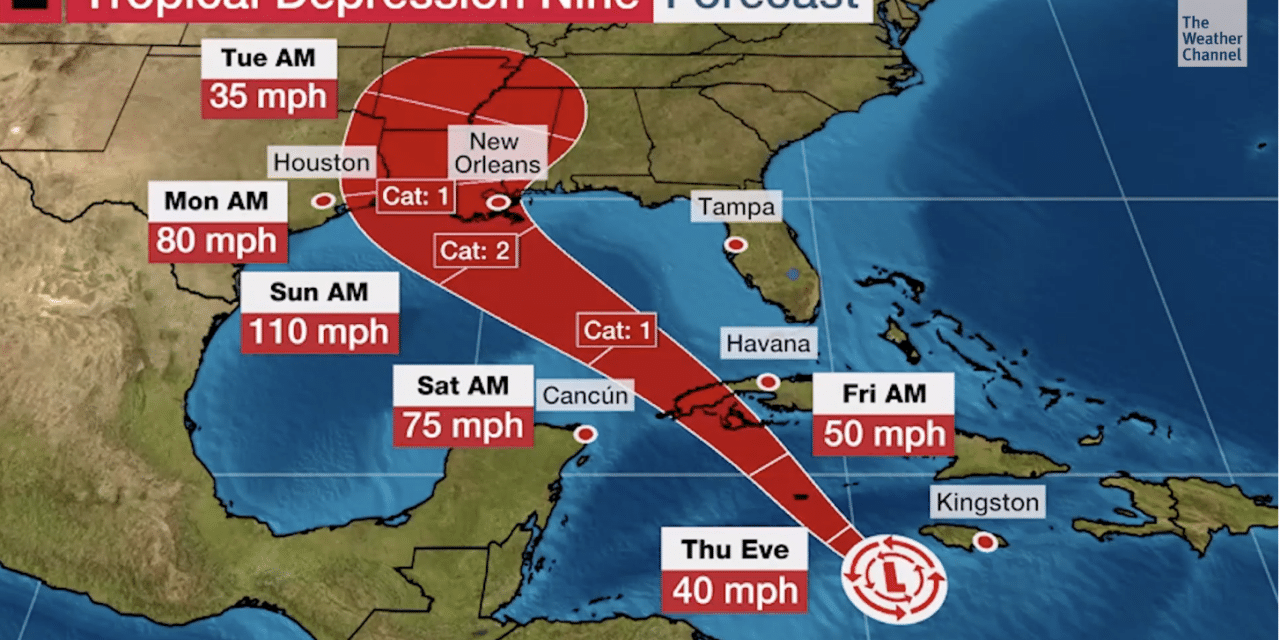
(ETH) – Tropical Depression Nine has formed in the Caribbean Sea and is likely to soon strengthen into Tropical Storm Ida before potentially threatening the northern U.S. Gulf Coast at near major hurricane strength by late this weekend.
The Weather Channel is reporting that it’s too early to know specific details about the impacts future Ida will bring to portions of the U.S. Gulf Coast, but interests from Texas and Louisiana to Mississippi, Alabama, and the Florida Panhandle should monitor its progress closely.
The National Hurricane Center (NHC) says there is the potential for hurricane-force winds, flooding rainfall, and life-threatening storm surge in parts of this region by Sunday and Monday, especially in Louisiana.

Accuweather is reporting that on Thursday afternoon, the depression was moving to the northwest at a speed of 13 mph and had maximum sustained winds of 35 mph. It was 95 miles south-southwest of Negril, Jamaica, and 165 miles southeast of Grand Cayman Island.
The latest forecast from AccuWeather meteorologists indicates that a scenario in which the depression will continue to increase in strength and take a path into the central Gulf of Mexico is now more likely than had been discussed earlier in the week.
The chances for what will likely be Ida to make landfall in southern Mexico were dimming, with a greater focus now being paid to parts of the western Gulf Coast of the United States. The pace at which the system strengthens will be key in determining the precise direction it ends up taking, AccuWeather Senior Meteorologist Rob Miller said.


