
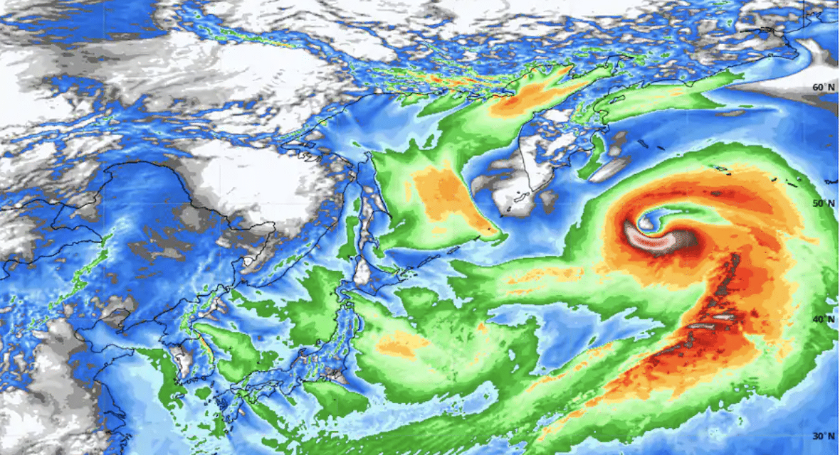
(WP) – A powerhouse storm explosively intensifying in the northern Pacific could rank as the strongest nontropical cyclone observed in that ocean basin. The storm’s pressure is predicted to drop as low as 920 millibars on New Year’s Eve, which would be even lower than extreme cyclones that formed in the same vicinity in 2014 and 2015.
The lower the pressure, generally, the stronger the storm. The National Weather Service’s Ocean Prediction Center confirmed that the storm is already generating hurricane-force winds, and forecast models suggest gusts could top 120 mph on Thursday. The European model predicts the storm’s pressure to bottom out at 919.9 millibars around 9 or 10 a.m.
Eastern time Thursday. The two northern Pacific cyclones that set records in 2014 and 2015 saw their pressures level off at around 924 millibars. At 7 a.m. Wednesday, the European model had analyzed the storm’s pressure at 972 millibars. It predicts the pressure will tumble to 921 millibars just 24 hours later, a 51-millibar drop.
This plunge in pressure is double the criteria for “bombogenesis,” in which a storm’s pressure drops 24 millibars in 24 hours and earns the “bomb cyclone” moniker. This 2020 Pacific bomb cyclone and its ultralow pressure represent an amazing contrast from an exceptional high-pressure zone over Mongolia, which may have set a world record on Tuesday. READ MORE


