
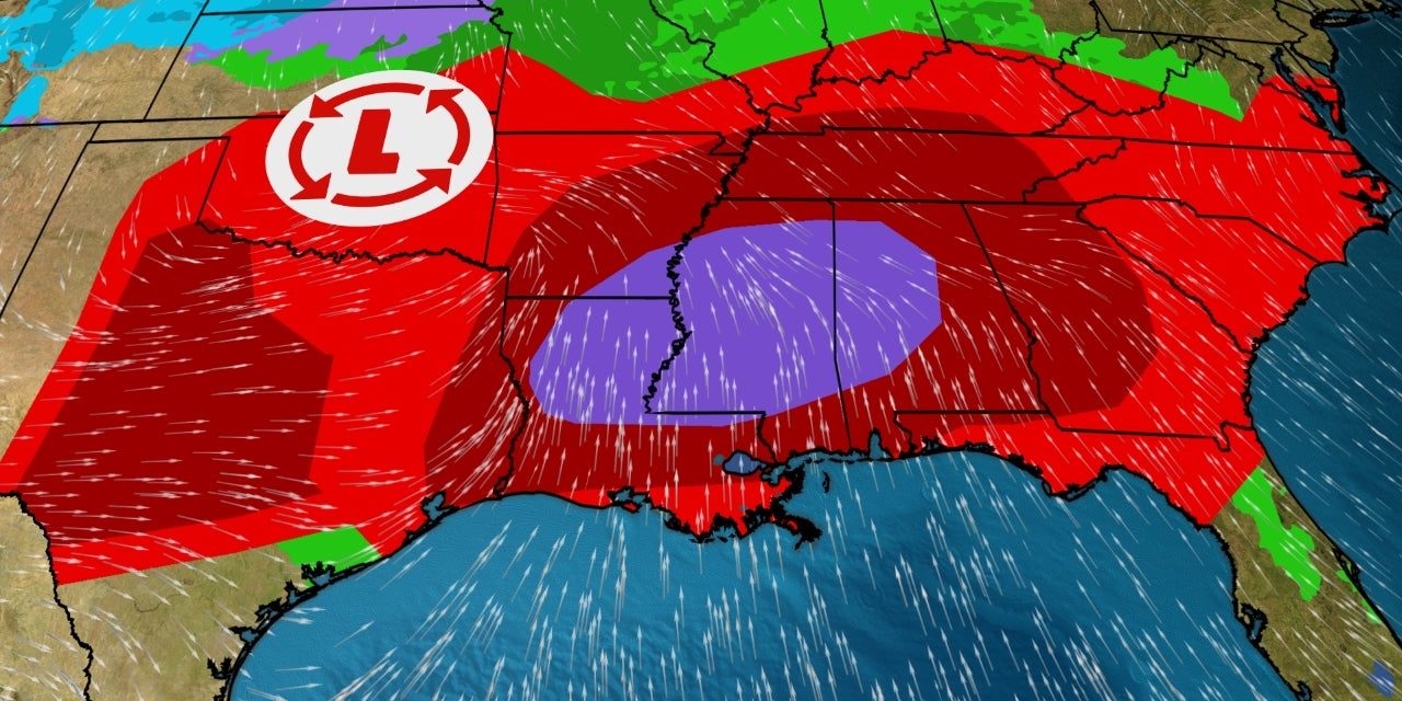
(TWC) – A dangerous severe weather outbreak is likely across a large part of the South over Easter weekend, including threats of tornadoes, widespread damaging winds, very large hail and flooding rain.
April is a notoriously volatile month for severe thunderstorms and tornadoes in the United States, and the overall setup this weekend has grabbed the attention of meteorologists. A slow-moving upper-level low-pressure system that brought rain to California and the Desert Southwest much of the week will finally accelerate eastward this weekend.
This area of low pressure will rapidly strengthen as it tracks from the Plains into the Great Lakes. Increasingly warm and humid air is expected to stream northward off the much-warmer-than-average Gulf of Mexico ahead of the upper-level low, providing fuel for thunderstorms. In fact, a strong atmospheric river from the Gulf of Mexico will be in place by Sunday night.
Increasing wind shear – the difference in wind speed and/or direction with height – will support severe thunderstorms. This overall setup is fairly clear. But there remain some uncertainties in the details of this severe forecast. First, these upper lows moving out of the Southwest are among the biggest stumbling blocks for computer models and weather forecasters. They often move slower than expected and make forecasts a challenge. READ MORE


