
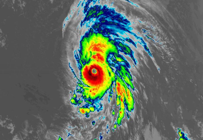
(Forbes) – Hurricane Lorenzo is a powerful category four storm this evening, packing maximum winds of 145 MPH far out in the Atlantic Ocean. Lorenzo joins the heap of storms we’ve seen in the last couple of years to break some sort of a record—this time, it’s the most intense hurricane ever recorded so far east in the Atlantic. While it’s no immediate threat to land, the hurricane may pose a threat to the Azores Islands by next week. Lorenzo is darn impressive on satellite imagery tonight. The storm has a thick core surrounding a big, clear eye. The latest forecast from the National Hurricane Center indicates that the
hurricane is at or near its peak intensity, and Lorenzo should soon start to lose atmospheric support and begin to slowly weaken over the next five days. Meteorologists have never recorded such a strong hurricane so far east in the Atlantic Ocean. Lorenzo’s minimum central pressure of 939 mb is the lowest on record this far east, according to hurricane expert Philip Klotzbach. The hurricane’s maximum winds, which clocked in at 145 MPH on Thursday night, were also a record for so far east in the Atlantic. The last storm to reach 145 MPH in this vicinity was 1988’s Hurricane Helene, which didn’t achieve its peak intensity until it was 400 miles to the west of Lorenzo’s current position. READ MORE


