
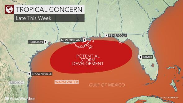
(AccuWeather) – After more than a month of inactivity in the tropical Atlantic basin, development is likely in the northern Gulf of Mexico with potential impacts to residents and visitors later this week and this weekend. A non-tropical system tracking through and triggering showers and thunderstorms across the South early this week will eventually end up over the warm waters of the Gulf of Mexico around midweek. “The storm will then sit over the Gulf of Mexico for a few days and may eventually become
partially or fully tropical in nature during the time period from late this week into next weekend,” according to AccuWeather Senior Meteorologist Adam Douty. Dry air, dust and strong wind shear has prevented tropical development across the Atlantic basin since Subtropical Storm Andrea briefly roamed the waters of the west-central Atlantic in late May. However, more conducive conditions exist over the eastern Gulf of Mexico. With strong wind shear absent, warmer-than-normal waters of the eastern Gulf of Mexico can allow an organized tropical or subtropical system to take shape. READ MORE


